While out and about today and still looking for the perfect prairie grass I took highway 53 back rather than 93 (I already knew what was on 93 from an earlier trip). While I didn’t find the ideal clump of prairie grass, I did find a nice turnout, with a good view, that was westward looking.
(more…)
Buena Vista on Highway 53
September 14, 2014 Photography 1 comment geo:lat=44.497882819865445, geo:lon=-91.21038436889648, geotagged, Osseo, scenic view
Lytro at Mitchell Park
May 3, 2014 Flowers, Photography No comments geo:lat=43.0261557, geo:lon=-87.9463935, geotagged, lytro, Milwaukee
Tillamook to Kalaloch
September 26, 2008 Great Trip '08 No comments Forks, geo:lat=47.60494457887769, geo:lon=-124.37321552883606, geotagged
Today’s trip was a simple one up the coast. I’m glad I took the day before to have that extra about two hours of Salem to Tillamook rather than trying to do Silver Falls to Kalaloch in one day – it would have been quite long.
The day started with the smell of dairy air. Tillamook is indeed a dairy area. I headed out a bit later than I would have liked, but not too bad. I blame the TV and discovery channel. They had a program about infrastructure.
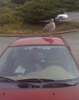 I headed north on 101 and came to Cannon Beach. It took a bit, but around noon I was able to get some photos with no one in the frame while shooting north at the south end of the beach. I had to persuade a sea gull that it didn’t want to go with me. And then on the road again.
Before I leave Oregon I want to point out that Oregon has an obsession with signs about the laws. No engine braking, do not pass, if there is a solid yellow line it is unlawful to pass, it is the law that slow vehicles must use turn outs (note: not enough turn outs). About one every five miles or so.
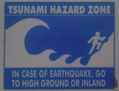
The other thing I’ve seen is tsunami hazard zone signs. There are signs saying entering and leaving the area, and then evacuation routes. Just something that I’ve seen along the way.
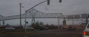 The first major thing was the bridge across the Columbia River. This is not a small bridge. That is four lanes on top of there and quite long. The GPS tells me it is the Astoria Bridge. About four miles long. That first bit is over the deep part of the channel – the GPS says there is a 33 to 39 foot deep section. The North end is 60 feet deep, while the middle is only 20 feet deep. Anyways, driving over this I’m thinking of that discovery channel program on infrastructure and thinking “gusset plate, gusset plate.”
The rest of the trip was really quite uneventful. Such things as pumping my own gas again at Quinault and chatting with a beautiful Australian sheep dog at the station.
I missed getting down to the beach at low tide here by a little bit. With the almost new moon high tide is at noon and midnight and low tide is at 6 am and 6 pm. I then waited for sunset, but it wasn’t that spectacular. Did catch few frames though.
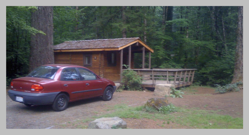
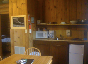 Dinner was great. At the lodge dining room relaxed with a steak and a glass of local red wine. Yes, the price was a bit… and these are not cheap days spent here. But it is very nice to relax in a cabin… These are not primitive cabins either. Full water and electricity. Stove and small refrigerator. Heat is from a Franklin stove. I’ll go for eating “in” one of these nights. A rice dish with the stove going.
Silver Falls to Tillamook
September 26, 2008 Great Trip '08, Photography, Waterfalls No comments geo:lat=45.4743408, geo:lon=-123.84283299999998, geotagged, Tillamook
The day started with packing up and then a trip to Upper North Falls. The rain from the previous day had a significant change to the amount of water over the falls. I think I preferred the day before for the possibility of more detail in the rocks, but you take what you get.
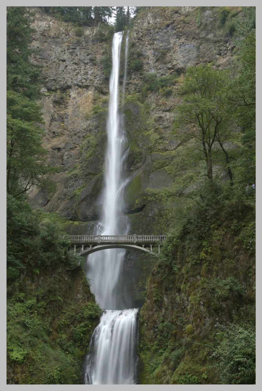
Following that it was up to Multnomah Falls… one of the, if not the, most famous waterfalls in Oregon. The GPS wanted to take me on the highway, but I saw a sign that said “that way” and so I went “that way” – it was the historic part. It was built for the model T. White picket guard rails, turns that had a 20 mph speed and straight away that were 30 mph. It gave you time to see the view… and I saw cars whizzing by on the highway over a bit. I thought I made a wrongish turn – that would take too long to get there.
Silver Falls – Hiking
September 25, 2008 Great Trip '08, Photography, Waterfalls No comments geo:lat=44.8711186, geo:lon=-122.65192860000002, geotagged, hiking, Silverton, waterfall

Base of Middle North Falls.
The odometer should be taken with a grain of salt or two… The loop that I hiked was listed as 8.7 miles. The canyon trail was, well, in a canyon and the GPS doesn’t like canyon walls. The other thing the GPS doesn’t like is rain. I’ll get back to that.
Burney Falls to Silver Falls
September 23, 2008 Great Trip '08 No comments geo:lat=44.8711186, geo:lon=-122.65192860000002, geotagged, Silverton
Last night I packed up everything that wasn’t in the tent – I knew I had a good drive tomorrow to do. Set my phone with an 8 am alarm and put it in airplane mode so that it battery drain would be as low as possible. Woke up at 8, got up at 8:15 and took everything out of the tent and packed it away. When taking it down I found that poles first then clips would work better… well, next time. I was on the road at 9:15 with only a short pause to get the inverter to work and charge my phone.