The day started with packing up and then a trip to Upper North Falls. The rain from the previous day had a significant change to the amount of water over the falls. I think I preferred the day before for the possibility of more detail in the rocks, but you take what you get.
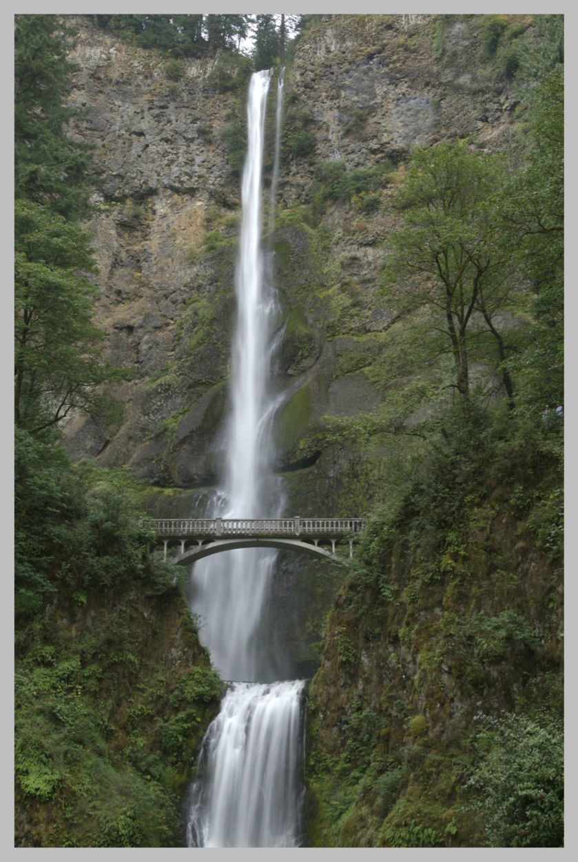
Following that it was up to Multnomah Falls… one of the, if not the, most famous waterfalls in Oregon. The GPS wanted to take me on the highway, but I saw a sign that said “that way” and so I went “that way” – it was the historic part. It was built for the model T. White picket guard rails, turns that had a 20 mph speed and straight away that were 30 mph. It gave you time to see the view… and I saw cars whizzing by on the highway over a bit. I thought I made a wrongish turn – that would take too long to get there.
Starting from the Vista House at Crown Point, I drove on. Then I saw waterfall after waterfall. The Columbia River Gorge has a number of waterfalls on them… and I stopped at most of them.
I need to come back here again some day… just spend a few days in Portland and then go out to each waterfall, and spend as long as I want and then go back at sunset. Repeat until the entire way is photographed.
After spending some time at Multnomah Falls, I continued down (the way to highway 84 was faster in that direction) and then back to Portland.
I hit Portland at about 4pm – and rush hour was starting up. Not as bad as San Francisco (or so it felt to me, maybe just less distance to go). Still, a bit slow. I would like to apologize to the native drivers – I am an out of towner, driving a car with little acceleration, and had the entirety of the instructions of “26 or 6 will get me out to the coast” as I glanced at my gps before.
And so, as I got further away the traffic got less and less. Eventually I got through the mountains and forest and saw dairy cows. Holsteins and jersey cows – Tillamook is known for its cheese.
I turned on to 101… quite a bit different than 101 in San Francisco. Same road, just a bit further north. I turned in at the first hotel of a known chain and I type this now sitting in a nice room.
This had the added advantage that I was able to get a web connection and make a reservation at Kalaloch Lodge. It was a place I wanted to go to on the trip. Yep, I know, not camping, still…
Another day of travel – this time on 101. The only planned stop along the way is at Cannon Beach. I hope they’ll let me use a Nikon. Google Maps says it is 4.5 hours for a drive.
- N 45.47414
- W 123.84208
- Elevation 13 feet
- Max Elevation 1810 feet
- Trip Odometer: 217 miles
- Odometer: 936 miles
codemore code
~~~~