The fall color report on Travel Wisconsin has had a tantalizing photograph on its gallery from last year. So, I decided to head down to figure out what some of the buttons on the new camera does and how to use them before I need to use them. So, a trip to Pewit’s Nest was in order.
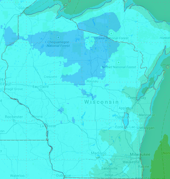
For some reason, there’s something about my trips to places and having low air pressure in the tires. I’m going to specifically blame this on a cold snap that hit the area. The low for the day was 40° F and the high 55° F (the low for overnight is 33° F which means a chance of frost spotty in some areas further north – this may mess up some colors if the leaves freeze, they turn black instead of red). There is a bit worse on its way overnight – that blue is below freezing.
Anyways, a drive to Pewit’s Nest showed some individual trees along the interstate that were starting to change, though nothing as a trend overall in any area. The parking area for Pewit’s is rather nondescript – I drove past it once.
Shore at Pewit’s Nest
The classic photo (like the one that tantalized me) is shot from the shore of a sandy beach. I would presume in the spring this could be rather wet and you might need some waders, though in the fall this wouldn’t be an issue. The walk to the shore is short – one could lug a heavy tripod there with no problem.
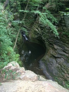
Pewit’s Nest canyon and pool
Going up along the canyon there is another waterfall that has a nice, deep pool that local youth apparently jump into. I’ve gotta say that tree annoys me.
And, well, the trail goes back quite a ways further in a mature maple mini-forest. All along the trail on the canyon rim you can look and see a corn field not more than a few feet away on either side.
Eventually, the canyon walls go back down to level with the water and, well, goes into a corn field. Apparently, there’s a wide and flat waterfall built on sedimentary rock further back called Skillet Creek Falls that sits on privet property.
Some places will claim that the falls within Pewit’s Nest are Skillet Creek Falls, but the topo map properly shows otherwise.
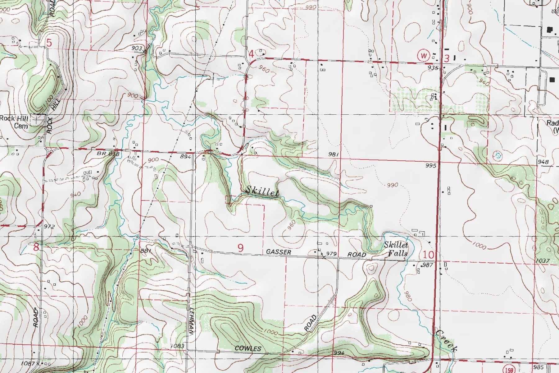 The Canyon is along where its ‘Skillet’ in the middle, while Skillet falls is quite a bit further up stream. The name Skillet Creek is from a rock formation at the falls.
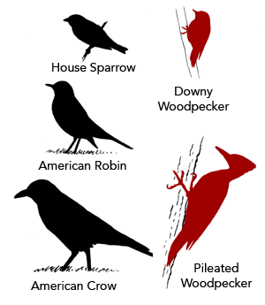
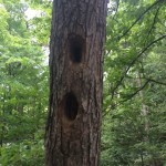 There’s a pileated woodpecker in the area. Think of a woodpecker that is as big as a crow. This is not a small bird and while its quite elusive to actually see, when you know what to look for in its range, you will be able to see that one has been in the area. What I saw was a large rectangular hole in a dead tree.
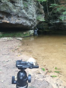
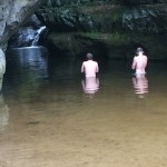 Back at the lower portion of the canyon, there were two men who had an accurate display of how deep the water was a ways in if one wanted to try to get different vantage points. The channel for the water runs deeper as one heads further to the right of the canyon looking up stream.
For the classic photo itself, on a full frame camera I shot with a 70-200mm lens and was quite pleased with the results (though I still have to figure out what all the buttons do and how to get the autofocus where I want it to be). If Ted Orland is correct, “three buttons on your camera serve absolutely no purpose whatsoever” which I suspect is more true now than ever before.
 Heading back home I took another route than just the straight interstate. The way down felt like a bit of a slalom with alternating lanes being closed for the last bit of road construction before winter. I found a few spots that had some nice prairie grass. I’d like to see about photographs similar to one that I took a number of years ago.
There were also two spots along Highway 93 that I was reminded of when driving that are marked as scenic turnouts (google street view). They certainly have the possibility of being nice places to photograph, especially for those too in the morning early sunrise photos (they look out to the east). The tree growth there could use some pruning – it has likely grown since the turnouts were made and can obscure much of the wide angle views. This is likely easily worked around by walking out of the turnout, along the road to just a bit further down to see, but then you’re photographing on the shoulder of a narrow road along the hills in the pre-dawn.
codemore code
~~~~